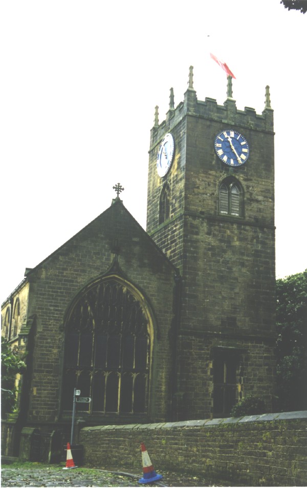
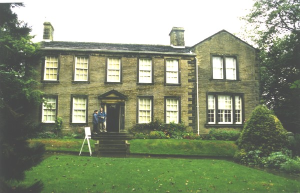
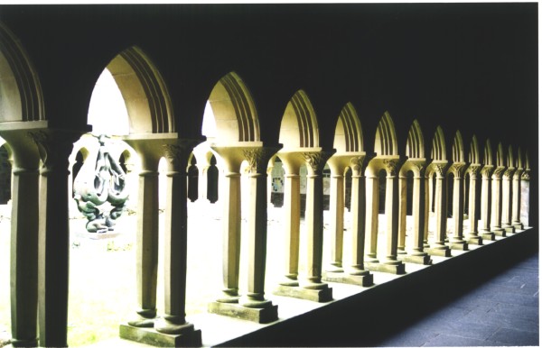
WEEK 3DAY 15Haworth and the BrontesNorth on the A60, then north on the M1 (our first experience of this roading wonder) then northwest on the A629 and A646 to Hebden Bridge. This was now Yorkshire moor country. Finally onto the A6033, and a few miles north we were in Haworth, in Bronte country. The weather had turned suitably overcast with frequent drizzle, but we were able to walk around the small village of Haworth, dodging the puddles and slippery cobblestones. It appears that Haworth continues to exist solely for its Bronte heritage. Every house, shop, tea room (there are plenty) proclaims some direct connection - a Bronte dined here, another Bronte drank here etc. Anything to entice the 10 pound note out of one's wallet. The Bronte Museum, occupying the original church manse, is very well maintained and has excellent presentations on the life and events of the Bronte family. It is well worth a visit. (More info...)
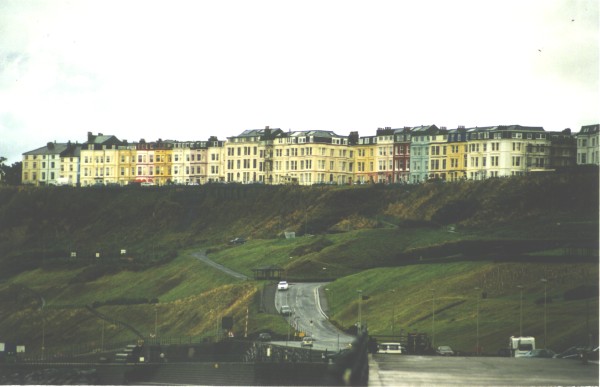
ScarboroughDeparting Haworth we planned to head north on the A629, but an error of map reading took us west across Keighley Moor instead, past Ponden Reservoir. We eventually went through Skipton then east on the A59 to York. We had planned some time in York, but traffic delays meant we were running late, so we took the A64 to the coast at Scarborough, finding a cold, windy and wet outlook onto the North Sea. The size and abundance of the apartment buildings overlooking the beach suggested that the weather did occasionally brighten up.
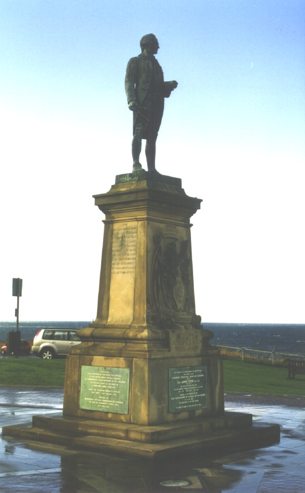
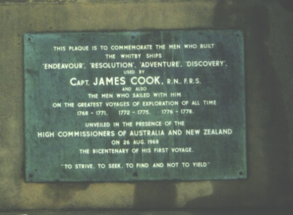
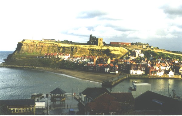
WhitbyNorth of Scarborough lies Whitby, the small port town that was home to Captain James Cook. We arrived mid-afternoon in a heavy downpour of rain but this cleared to alternating sun and dark cloud. By the time we had found our way around and found a car park, the Cook Museum beside the wharf had closed (even though it was only 4.15pm). There was nothing else to do but head west for the evening.
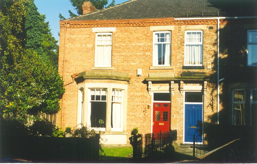
DAY 16Darlington"Why stop at Darlington?" we were often asked, "it has no endearing features". That may be, but my great-grandmother and her only daughter and son-in-law both lived and died there in a small, neat terrace house close to the centre of town. We found the location, the only apartment in the street to be bathed in early morning sun.
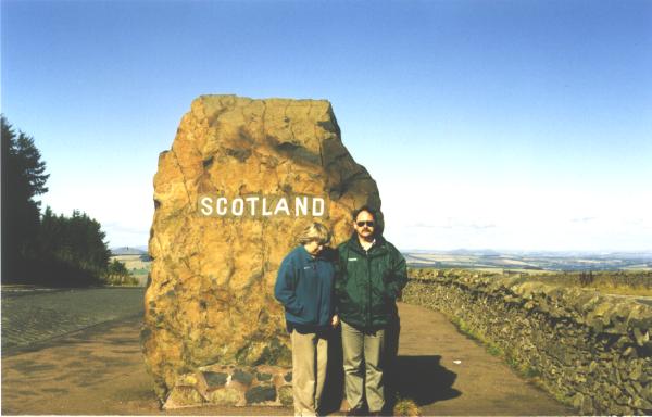
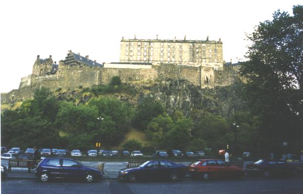
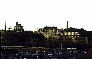
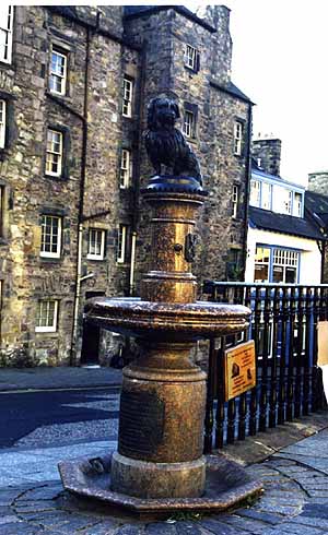
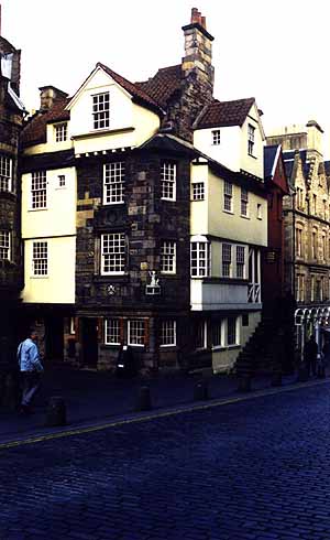
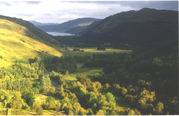
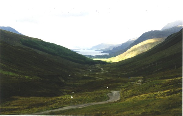
North to ScotlandFrom Darlington we headed north on the A1 for a while, past Durham, then NW on the A696 to the A68, through the Northumberland National Park characterised by numerous warning signs of the danger of military activity, eventually reaching the border to Scotland. The border is well signposted with a nice parking area and being on the top of the Cheviot Hills has an expansive view north over the Borders region. There were several cars parked nearby with people sheltering from the cold wind. The purpose of their loitering became apparent as soon as the next tour coach pulled in - the occupant leapt out, pumped up his bagpipes and played a welcome to the tourists as they filed off the coach, photographed him and the border, dropped coins in his carefully placed sporran and dashed back onto the over-heated coach. As soon as the coach door closed the piper was back into his car and into a dram of warming liquid, no doubt, waiting for the next coach. Chester's FortJust north of the border is the turnoff on the A6088 to Chesters Roman Fort, a major location on Hadrian's Wall. This was our chance to see part of the wall, and a Roman location in Britain. Chester's Fort is under the care of English Heritage, who provide a very good display at the entrance, as well as a collection of hundred of artifacts found on the site. It is well worth a visit. (More info....) We turned north on the B6357 to rejoin the A68 at Ferniehurst. This short section of road cuts across the river drainage pattern on the north slope of the Cheviot Hills so undergoes many rapid rises and falls as you cross small valleys and ridges. At a suitable speed the car comes close to airborne on the crests of the ridges, an exciting ride for the firm-of-stomach. We then followed the A68 to Edinburgh. EdinburghWe navigated our way into central Edinburgh, found the Travel Inn where we had booked for a night then set out on a warm sunny afternoon to explore central Edinburgh and the Royal Mile. We walked around the base of the castle then up a flight of steps to the courtyard in front of the Castle. From there it was downhill, down the Royal Mile past all of the shops and buildings, past John Knox House as far as Holyrood, then back again. A detour took us to the statue of Greyfriars Bobby
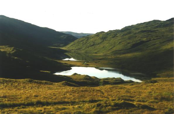
DAY 17Edinburgh to WickThis was always planned as a long day of driving to cover the miles towards the north of Scotland. We headed north over the Forth Road Bridge, through Inverkeithing where my g-g-grandmother was born, then followed the M90 north. Dunkeld and Beatrix PotterTurn off into Dunkeld and you will find a wonderful small museum and outdoor garden dedicated to Beatrix Potter. (More info...). The early morning frost was still in the shaows when we visited, so the indoor area was more inviting, but still well worth a visit. PitlochryAt Pitlochry we turned off to visit the Blair Athol distillery. There are many small distilleries in Scotland but this one fitted best into our itinerary. The tour takes you through the historic distillery, past the large stills and the casks of whisky quietly maturing, then into the large tasting and shop building. Learning about true single malt whiskies, and the tasting was time well spent. North to WickFrom Pitlochry we followed the A9 north to Inverness, across the Firths of Moray and Cromarty then out to the coast of the North Sea at Tain. The road then follows the coast north, eventually arriving at Wick. This section of coast is wild, windswept and sparsely populated, but is remarkable for the number of historic sites that you pass. Wick is a town in decline. It received a boost with the
development of the North Sea oilfields, but as the fields have slowly
closed so has Wick. Despite what you might conclude from the Internet or the AA
Guidebook, B&Bs seem to be scarce in Wick and the one we found had also
seen better days. The beds were lumpy and squeaked, the light in the room did not
work, the bedside lamp would not turn on, and the "en-suite" had toilet basin
and shower but were built into a walk-in wardrobe. On top of this, it
was the most expensive of all the B&Bs we stayed in on our trip. We
were glad to arrive in Wick after a long drive north, but we were equally glad to
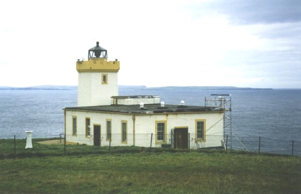
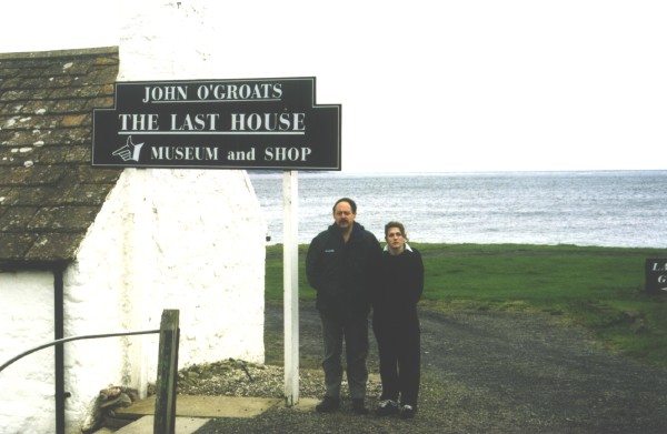
leave the next day. DAY 18Wick to UllapoolWe set out in fine but overcast weather, cold with a gentle northerly wind. Today was planned to be another long drive, covering all of the top of Scotland, around and down the west coast to Ullapool. First stop was Duncansby Head. Duncansby Head & John O'GroatsFirst stop was a few miles north of Wick at Duncansby Head, a cold windswept headland with lighthouse facing north towards the Orkney Islands. A short walk to the south lie the Duncansby Stacks, headlands of rock eroded out by the sea. Returning to the main road takes you into John o' Groats, often thought to be the most northerly point in mainland Britain, but it is not, just as Landsend is not the most southerly point. There is little to commend John o'Groats on a windy day, and even the touts charging to use their photographic backdrop were not keen to approach us (I think they were waiting for bigger fish - like tour coaches) so we snapped a picture of the Last House and drove on.
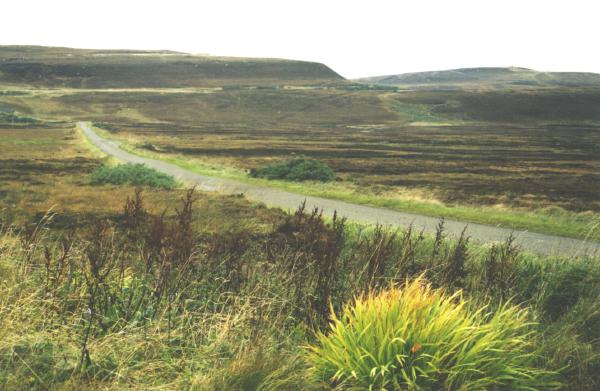
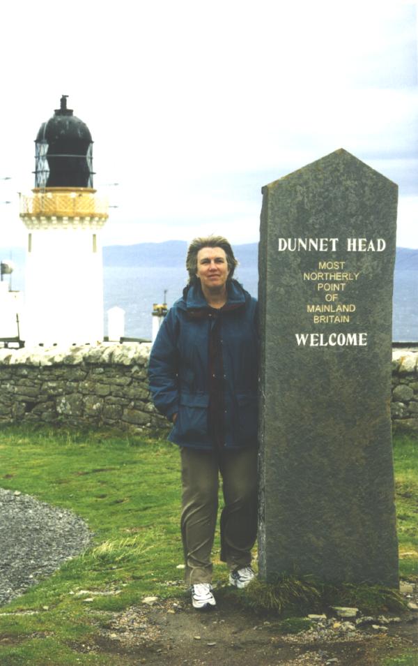
Dunnet HeadFrom John o'Groats the road heads west across the top of Scotland. After a few miles we turned north for Dunnet Head and the true northern point. The road out to the Head passes the small and narrow Loch Long then climbs through heather-covered peat land scarred by many years of peat mining.
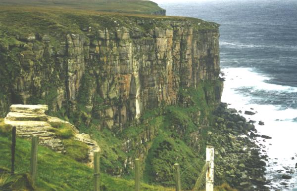
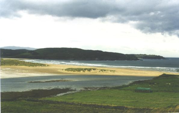
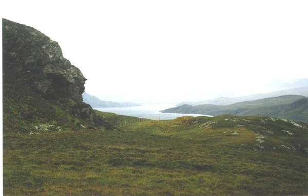
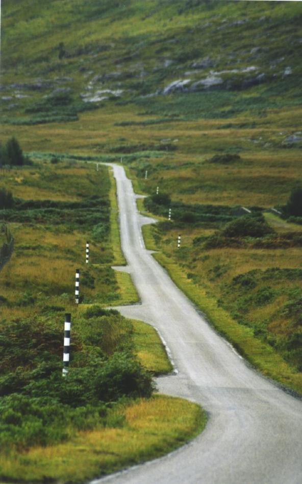
West of Dunnet the road passes over an undulating glaciated plain, through Thurso and its small port, Dounreay and the old nuclear reactor building dominating the skyline, then Strathy and another headland jutting out into the North Sea. The road then becomes more winding and climbs and drops over hills and valleys, before heading inland past the summer beach resort of Bettyhill. Admittedly the sand at Bettyhill was an enticing white-pale yellow but a cold windy day in mid-September did not enhance its beach resort status. Bettyhill & Loch EribollFrom Bettyhill the road runs inland for while, then winds and climbs over to Tongue before the causeway crossing the Kyle of Tongue and climbing again over the hill to Hope. Hope is near the northern end of Loch Hope, a long narrow body of water. Closeby is the large Loch Eriboll, open to the sea and tidal. The road follows the shoreline around the loch, running at the foot of the steep granite mountains on the western side. Then it is over another headland to Durness.
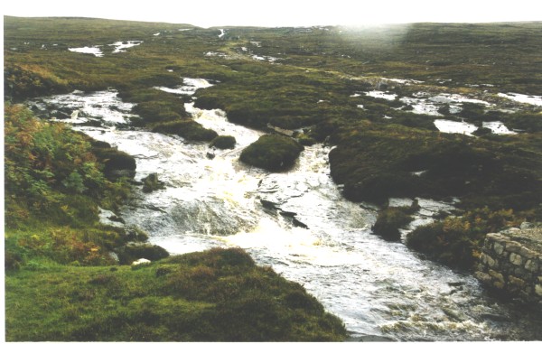
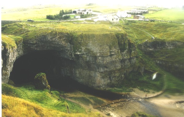
Smoo CaveJust before Durness the road drops into a shallow valley marked by a parking area and small stone visitor centre. This is the only indication of the attraction that lies below, under the road. The walking track takes you down the valley before dropping steeply to stream level. The path is well formed and the board walk takes you across the floodplain to the edge of the stream, where a bridge on wheels (either to remove it from the path of floods, or to act as a drawbridge if you do not pay the toll) takes you over the stream. However on the day of our visit the bridge had been moved to higher ground and the stream was up to knee height. The water was freezing but undaunted we shed shoes and socks, forded the stream and continued into the cave. There was water everywhere and the stream was a raging torrent pounding down into the cave and out through the entrance. Not surprisingly the sign said "Cave Closed due to Flood" so we climbed up the path on the other side of the valley and back to the car. (More info...).
From Durness the road heads south, across the top of the granite terrain dotted with small lakes and tarns, over Laxford Bridge and more small tarns before Scourie and Unapool. UllapoolAfter Unapool the weather seemed to become less oppressive, the clouds higher and the rain showers less frequent - perhaps this was just wishful thinking, or maybe the increasing influence of the Atlantic Ocean to our west - but by late afternoon we arrived in the port town of Ullapool and a welcome B&B a block or so from the edge of the harbour. Ullapool is an attractive port with many good shops and eating places.
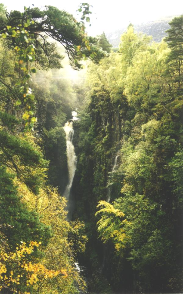
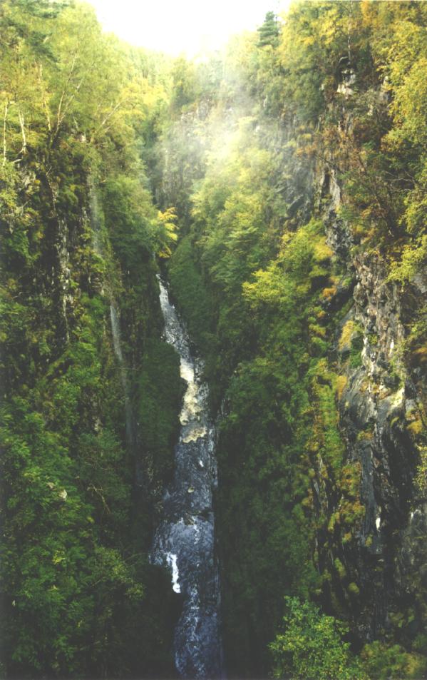
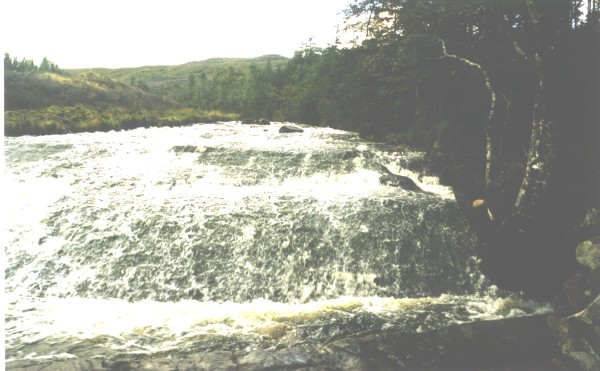
DAY 19Corrieshalloch GorgeSouth from Ullapool the road hugs Loch Broom then climbs through the Lael Forest to Braemore beside River Broom. Here the river has incised into a deep narrow gorge - Corrieshalloch Gorge - through which flows the Falls of Measach. There had been rain the previous night (I think there is rain most nights & days in Scotland) so the falls were in good voice, thundering through the gorge and producing a fine mist in the valley. There is a well formed pathway along the gorge and a swing bridge from which to view the falls.
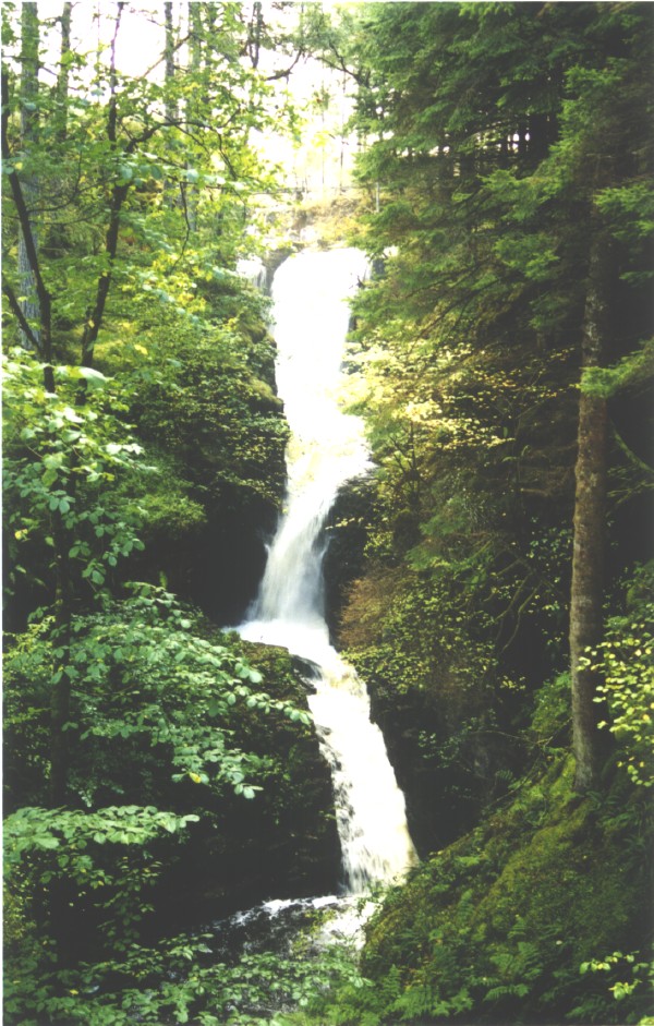
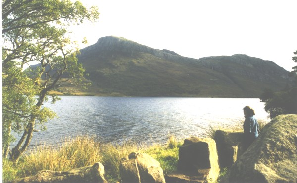
From Corrieshalloch we headed NW on the A832 to pass Little Lock Broom then the outer coast at Gruinard Bay, Loch Ewe & Loch Gairloch. The road then heads inland again to Loch Maree. Loch Maree & Victoria FallsJust after reaching the Loch the Victoria Falls cascade into the lake. It is pleasant walk through open forest to reach the falls. A few miles further on, at the head of the loch is the forest and reserve of Beinn Eighe. THe carpark beside the lake provides excellent views across the lake of of Slioch, the tall mountain dominating the eastern side of the loch.
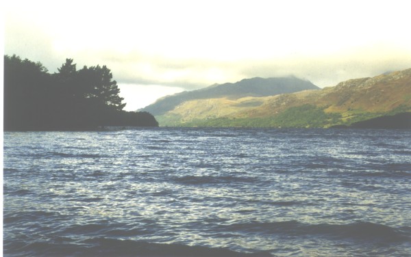
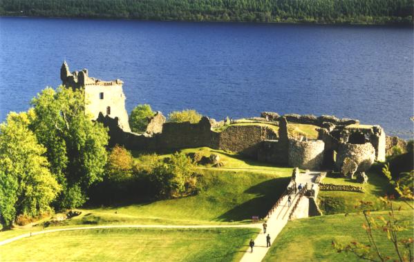
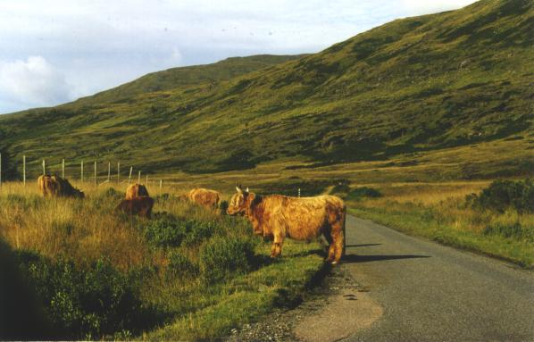
From Loch Maree the A890 took us SW to join the A87 then east to Invermoriston and Loch Ness. We turned north alongside Loch Ness expecting grand vistas of the lake, but only rarely caught glimpses of it through the trees. At Urquhart Bay we looked over the loch and Urquhart Castle then returned south through Fort Augustus, Invergarry, Spean Bridge, Fort William and eventually on to Oban.
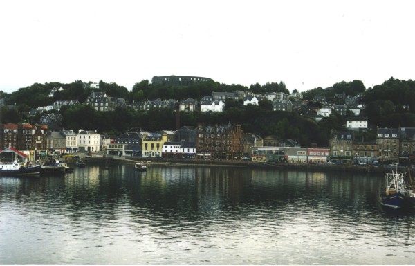
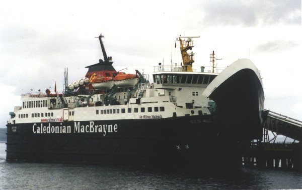
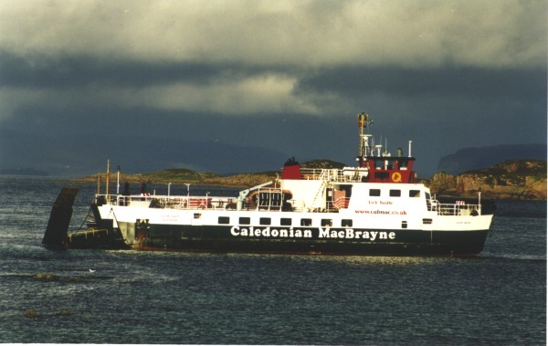
ObanOban is major port from which ferries depart to Mull and many points on the Shetland Islands. It is compact town, built around the waterfront, with numerous B&Bs and hotels and restaurants. DAY 20Oban to IonaWe caught the early morning Calmac ferry from Oban to Craignure Bay on Mull. The sun was low and mostly hidden in shower cloud, so our hat and gloves came in handy for the first time on the trip.
At Craignure we drove the car off the ferry and turned left towards Fionnphort at the other end of the island. The road is narrow and winding, and in most parts is only one lane wide but has numerous passing bays.
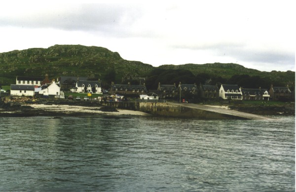
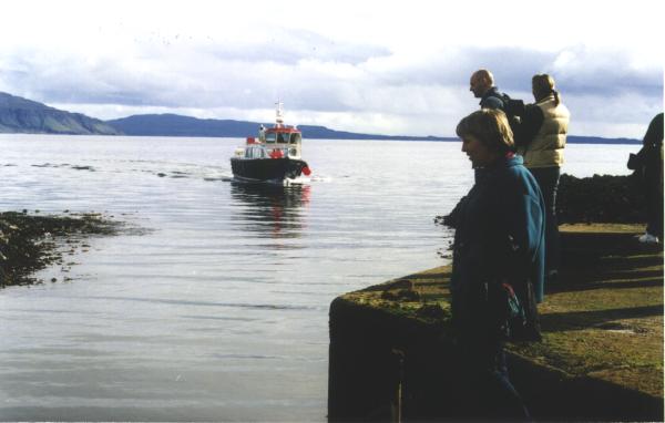
IonaWe arrived at Fionnphort at the same time as the rain, a heavy cold shower that obscured the jetty and all beyond it. The ferry appeared out of the cloud and we dashed aboard into the cabin carrying bags. The ferry to Iona is for passengers only although it can accommodate cars. But as the tourist brochures point out, a car is virtually useless on the 500m of road on the island. Five minutes later and the rain had cleared and we were on Iona. We walked the 200m from the wharf to the B&B at Shore Cottage, found our room and decided that as the weather would stay clear we would book an afternoon boat trip to the island of Staffa. With the booking secured we wandered back to the wharf and the cluster of shops and pub there, bought some lunch and waited for the boat. It was late arriving, dropped off most of its load of morning passengers then headed for Fionphort for more. The boat, now crowded, headed out past Mull towards Staffa.
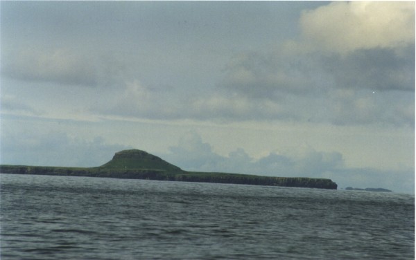
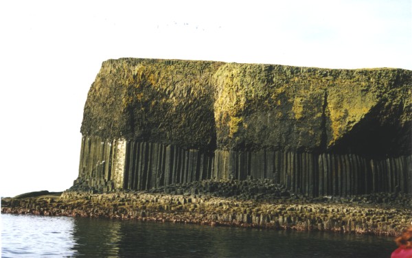
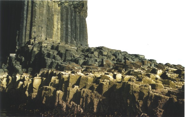
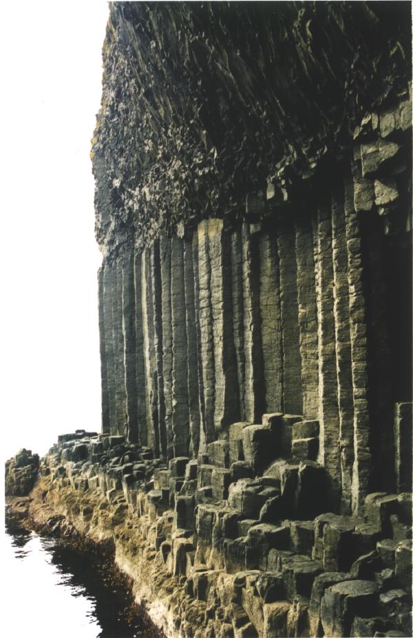
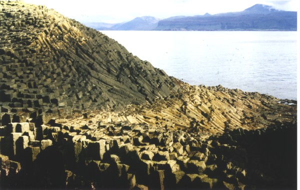
The Isle of StaffaStaffa is a small lump of basaltic lava without obvious connection to other islands. But the basalt cooled relatively slowly and evenly and cracked into regular columns. Staffa is one of the best examples worldwide of such columnar jointing, vying with the Giant's Causeway in Ireland and the Devil's Postpile in Oregon. Many people had warned us about the rough weather on the boat trip to Staffa, but this day produced perfect conditions - no wind, few clouds and glassy sea. We were soon passing the small island of Dutchman's Cap then Staffa loomed ahead. As we neared, the columnar jointing became obvious and eventually Fingal's Cave could be discerned in the shadow. The boat pulled into the small jetty, everbody dashed onto the island and the boat retreated. The jetty is at the base of a steep set of steps that takes you up onto a platform that circles the island, leading around to Fingal's Cave, and most people struggled up the steps and headed for the cave. A few others took the path to the top of the island.
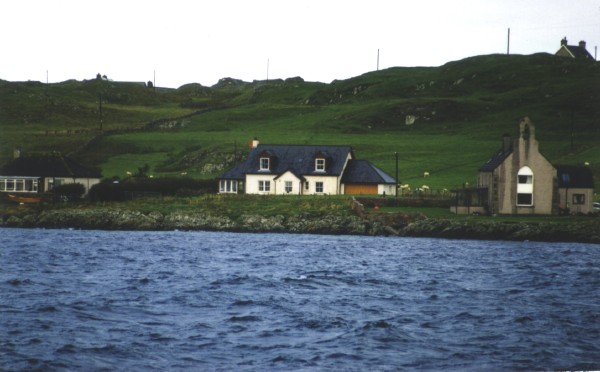
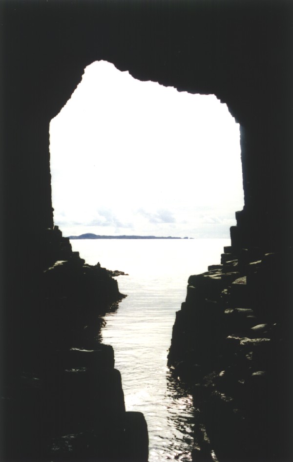
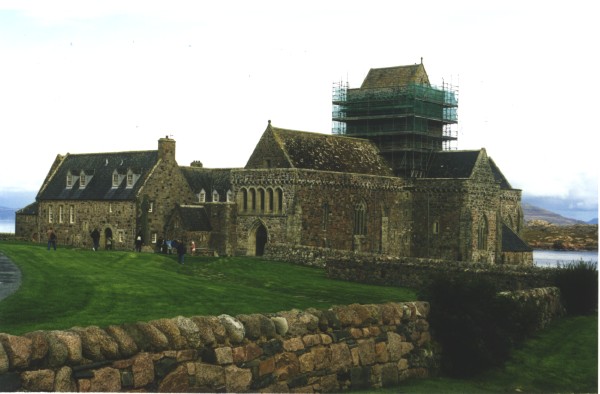
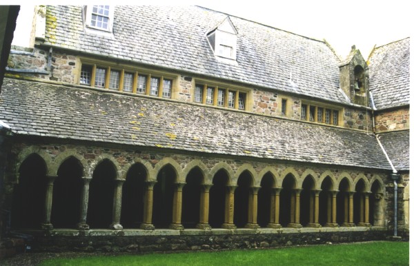
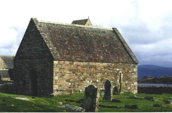
Fingal's Cave has been carved into the basalt by surging seas pounding the island. It is a deep cave with a ledge along one side, affording wonderful views out across the sea to Iona. We returned to Iona well pleased with our decision to visit Staffa that afternoon. We returned to Iona and dined in the local pub, to find it run by a group of Kiwis. DAY 21IonaSunday morning dawned overcast and cool but with long breaks between showers I decided to walk around the top of the island, past the Abbey, then down the western side. This took me across sand dunes, exposed granite and swampy peat, but it was an interesting experience. In the afternoon we visited the Abbey, Heritage Centre and surroundings.
Last updated: 15/06/2017 |