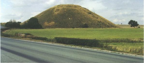
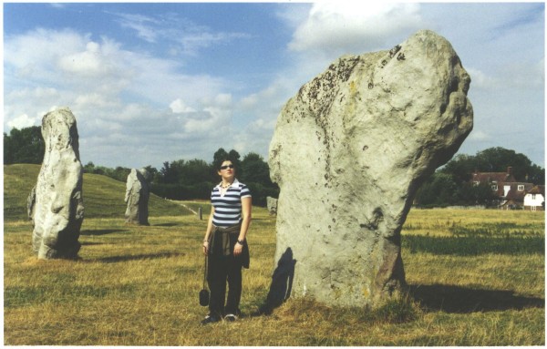
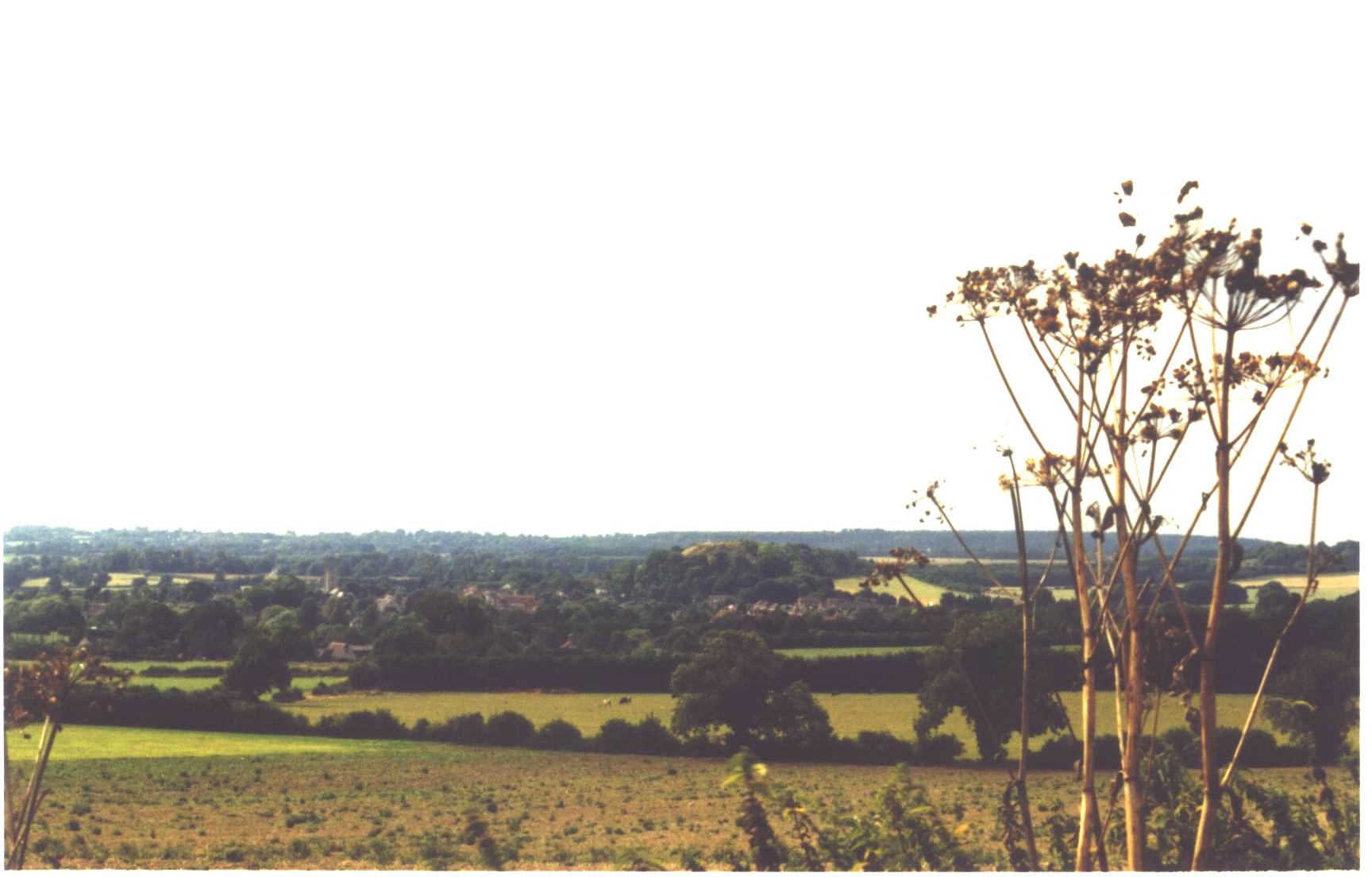
WEEK 1DAY 1So this is England... as we swooped into Heathrow from the west. Green fields punctuated by trees and lazy rivers (perhaps the upper reaches of the Thames or Avon? Couldn't find the map in my bag to check). Queue for Immigration. The Aliens Queue?? Us?? - with a thousand years of family ancestry in this island. There were Froggatts in Derbyshire before William arrived at Hastings. There are Froggatts buried in European fields who were desperate to keep those Europeans out of Britain. And now when we return those Europeans are finally getting their revenge - keeping us out. But we are of tenacious stock, and an hour later we are through the sheep race, getting a sympathetic ear from the Immigration official, then out into the early morning chaos of Heathrow, where English is a minority language. Lovely fine, sun-drenched morning, assume the infamous rain is lurking somewhere just behind Terminal 3. Ah, the Budget Rental Car counter - yes, we do have a booking. Well in that case you will need to go to our depot - about 5 miles across the other side of the terminal complex, no you cannot walk, but you can use our free bus that will arrive just outside. Yes, indeed, there was a bus and some time later we arrived at the car yard complete with security fence and guard. Signed the car lease, signed the extra insurance, signed the waiver, got lots of good karma for having a cell phone. Uplifted the keys and headed out to row 9 space 215, and there was a nice new Citroen with 19 miles on the clock. A French car on our English holiday..... oh well, this is the EU now. Loaded bags (x3) day packs (x3), camera bag etc. Unpackaged drink and food provisions, sunglasses, cell phones, other cameras etc, and then we saw IT - - - - - - - - the smashed rear taillight assembly - broken light, indicator and reversing light. No we cannot drive that around Britain for four weeks - "suit yourself" says the yard attendant. "Pop back inside and they will assign you a new car." So pop back we did after unloading 10 bags, cameras etc, then returning to the car for the sunglasses. "Yes sir you can have a replacement, just join the queue and we will fix you up." Of course time was advancing and it was now after 9.00am and the queue was growing by the busload. After some time we were at the head of the queue - again! Signed the car lease (again), signed the extra insurance (again), signed the waiver (again), got even more karma for a valid cell phone number. Uplifted the keys (again) and headed out to row 10 space 249, and there was a nice new FORD with 75 miles on the clock. A good solid English car for our English holiday. Our anger at the broken light subsided. Loaded bags and people and we were off - now what was that road number we were looking for again? Go west on the M4. Motorways are the same in every country, straight, multi-laned, full of trucks and fast cars, and most quite boring. After 20 miles we turned off onto the A4, a much more sedate and attractive route. Hunger caught us at Newbury, satisfied by the local bakery. Looked suspiciously at their "Kiwi Buns" - never seen anything like it at home. Then on through Hungerford, Froxfield and Marlborough. Silbury Hill and AveburySilbury Hill is an impressive circular mound attributed to the work of Neolithic people about 4600 years ago. It is reputed to be the largest artificial hill in Europe (More info....). We climbed to the top, admired the view then drove north a mile or so to Avebury and the famous Stone Circle. This is an impressive circle of large upright stones together with bank and ditch. We walked around the circle and passed through the village now built in the centre. (More info....)
For the first time, and not the last, we met present day England living unconcerned and apparently unnoticing, beside, around and amongst extremely ancient monuments. (Remember, in New Zealand our total human history is less than 700 years old and most recognisable remains are less than 250 years old.) StonehengeFrom Avebury we drove south on the A361 and A360, through Devizes to the A344 and Stonehenge which we came on rather suddenly. As usual there were crowds of people, but we paid our �6 each and walked under the A344 and up close to this most famous of all Neolithic sites. For all the history, photography, study and hype, Stonehenge at 6.7m high is remarkably small. (More info....)
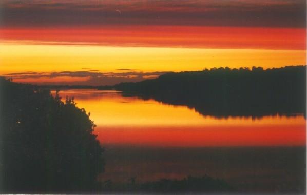
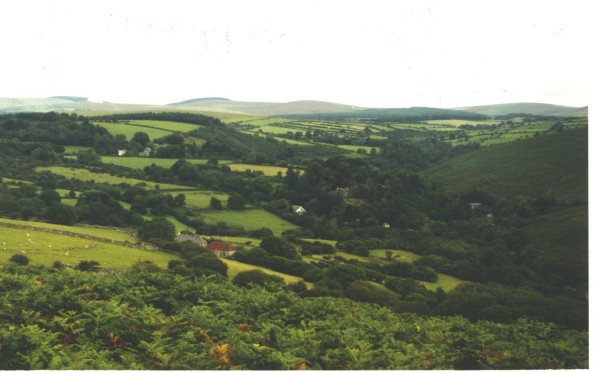
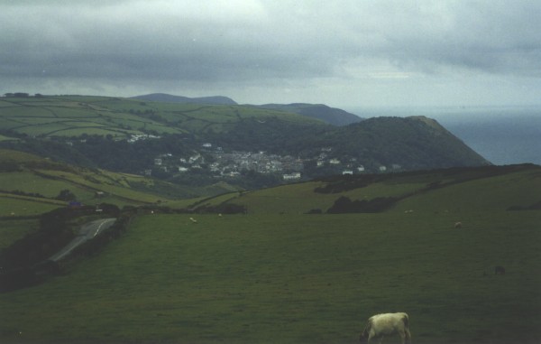
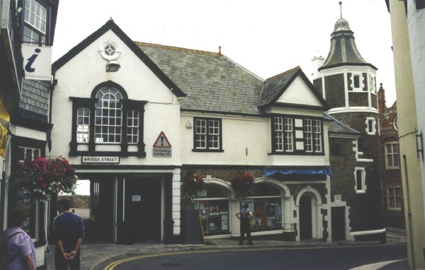
And on to Kingsteignton & Newton AbbottFrom Stonehenge we followed the A303 SW towards Exeter and the timeshare unit we had booked for the first week. The road travels through classical Wiltshire/Somerset/Dorset rolling countryside - farmland scattered with small villages. In hindsight this is typical of much of England (Wales and Scotland have more hills) but it was all new to us. The town of Mere is typical. Our timeshare was on the north bank of the River Teign at Kingsteignton, a few miles south of Exeter in Devon. By late afternoon our energy and concentration were flagging after a long day and even longer flight, so road signs, roundabouts and directions were losing their real meanings. However we did manage to find Newton Abbot, but had to drive around it twice to find Sainsburys, stocked up on groceries, bread, milk and wine and mostly by luck found the Passage House Club and our lodgings. The Hotel, timeshare and inn/restaurant faces the River Teign and has superb views across the river and downstream to the mouth at Teignmouth. The river faces east, as we discovered at sunrise the next morning...
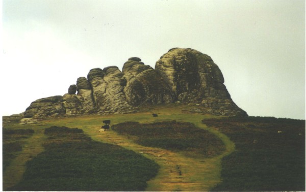
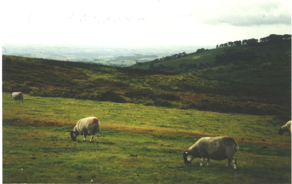
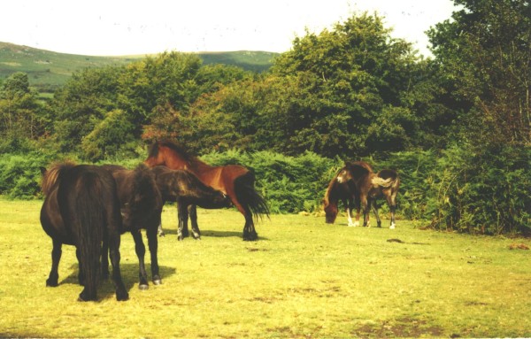
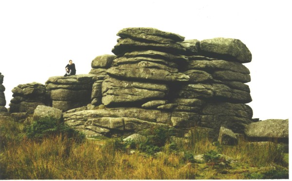
DAY 2DartmoorWoken early by the sun and not yet fully adjusted to local time we set out early to explore Dartmoor. We took the B3387 from Bovey Tracey to Haytor, catching our first views of the rugged, exposed hills of Dartmoor topped with granite tors. Beyond Haytor we found the road to Widecombe in the Moor was blocked - today was the annual Dartmoor Country Festival and thousands of people were expected in the village. Although stopping us from visiting this famous village, it did force us to take alternative roads and lanes and gave us a tour of isolated and remote areas: Ponsworthy, Holne, Bench Tor; Hexworthy. We then circled back across the moor to Tavistock.
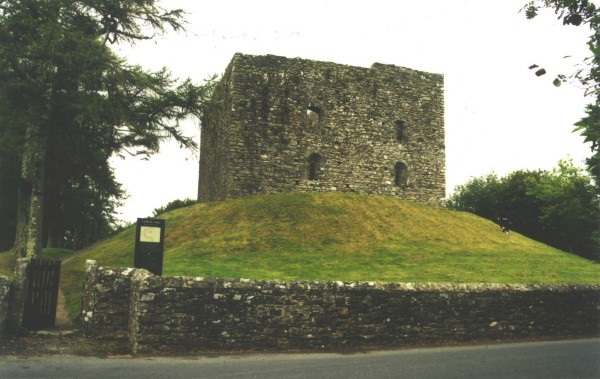
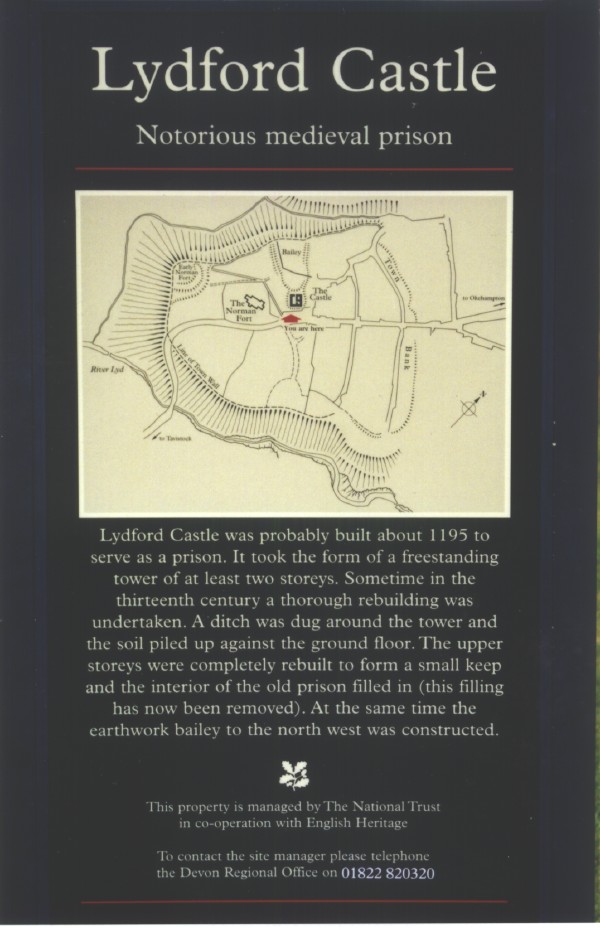
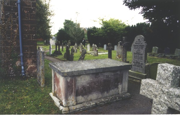
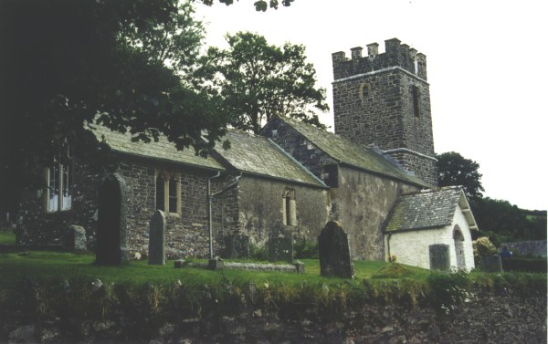
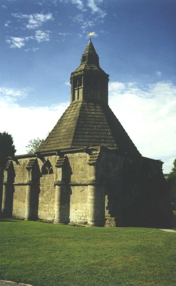
Lydford CastleAt Tavistock we turned north intending to visit the Lydford Gorge and walk to the White Lady Waterfall, but time was passing, and the entry price (akin to a ransom when converted to New Zealand dollars) decided us against it, so we settled for a picnic lunch beside the car park at the entrance to the NT walkway. Driving north we rather suddenly came upon Lydford Castle and were pleased to look at this "notorious medieval prison" built about 1195 as a prison. Again I was to marvel that a free standing stone structure with crumbling mortar could last over 900 years. They definitely don't have real earthquakes in this country. OkehamptonAt Okehampton we visited the Museum of Dartmoor Life, an excellent collection of material on the history of Dartmoor. Working models, old photographs, and helpful volunteers. From Okehampton we took the A30 east back towards Exeter, intersected the M5 without undue problem and continued east then south on the A376. A few miles south we found the side road to Clyst St George adn there we were in this samll rural village. Clyst St GeorgeThe village seemed to consist of a pub close to the A376, a few houses and a school attached to what would once have been a church. The churchyard was now full of flowers and children's play equipment, and across the lane was the village green. No sign of graves or headstones. We concluded that the church that we had been seeking had long been converted into a school and all records removed. Then I spied a small hand-painted sign nailed high up on a power pole "Parish Church 1/2 mile". A quick drive in the car and we arrived at this old brick church complete with bell tower, wrought iron fence and plenty of headstones. We had found the parish church of Clyst St George, and it did not take long to discover several headstones bearing the Goldsworthy name. The Goldsworthy family was obviously a staunch supporter of the church, as there is a vault, the only one in the church yard, positioned just to the right of the main door where the occupants have a close view of all who enter the church, with another headstone adjacent and almost leaning on the church wall for mutual support.
Around the corner from the vault, but next to the path is a third Goldsworthy grave:
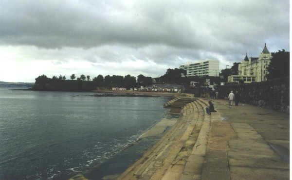
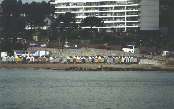
DAY 3We were becoming acclimatised to the weather and the roads but it was a false comfort as today was to be a test of our stamina, patience and endurance. We decided to follow the tourists to Torbay then head north to Exmoor....... TorbayTorquay and Torbay are only a few miles south of Kingsteignton where we were based but we soon ran into the thick of the British driver on holiday. The roads were narrow, winding and choked with cars. We crept past Torquay not even daring to enter this town, and on to the beach at Torre Abbey Sands. It was early morning, late summer but still you could see the rows of hotels, trinket shops, and deck chair lenders, just as we had seen in all those dreadful British comedies. They were now also dreadfully REAL.
Entering Torbay had been slow, but departing was a nightmare - over an hour to crawl the 2-3 miles to join the A385 and then we only went from crawl to walk. BuckfastleighEventually we reached our next goal, the Buckfastleigh Otter and Butterfly Park. Here we watched the otters (mostly North American species) run, dive and swim as they became more excited about lunch. They gobbled down their fish and we moved on, going north on the A38, then turning NW on the A382, eventually meeting the A377 at Copplestone and heading for Barnstaple. We then turned NE on the A39 and entered Exmoor. Lynton and LynmouthThese two towns on the north coast of Exmoor were names long-known from the book of Lorna Doone by RD Blackmore. We approached Lynton, being the town at the top of the cliff, and it was obvious that half of Britain had decided to visit on the same day. The small town full (actually over-full) of people, so we drove on, down the short steep hill to Lynmouth at the bottom. A lovely harbour town, but it too was awash with people. The afternoon was fast disappearing and we had to return to Exeter that night, so on we went. (Lesson: allow TIME to visit these famous places - either arrive very early and leave early, or arrive very late, stay the night and experience the location in the early morning). Rain was imminent (again) so we headed for Foreland Point then continued east along the rugged coast. Oare ValleyEast of Lynmouth the traffic and people decreased markedly (I still wonder how they all got to Lynmouth in the first place) so we headed off the A39 into the Oare Valley, home to RD Blackmore and the setting for Lorna Doone. Despite the fame of the location, the narrow steep rural road (or the late hour of the afternoon) kept the hoards at bay and we found the Church at Oare with its commemoration to Blackmore all but deserted.
Back on the A39 east then south on the A396 we headed back towards Exeter, reaching Tiverton about 6.30pm. Dinner was needed so we tried the local Indian curry and were satisfied with the fare. The food, drink and break was welcome after the winding slow drive on the A396. We then broke our habit of keeping off the motorways, using the M5 as a quick return to Exeter and Newton Abbott. DAY 4ExeterToday we had arranged to drive to Lyme Regis and have lunch with a couple we had met while they were on holiday in New Zealand. I had always wanted to visit Lyme and look at the famous cliffs from which all of the Jurassic fossils had been found. On the way we decided to visit the church at Sidbury where more Goldsworthys had lived. SidburySidbury is a small village centred around a cluster of shops and the Church. Many of the headstones in the churchyard have been removed (or destroyed) but this is not too surprising as the Church boasts that the crypt and part of the tower date from Norman times. The Goldsworthy family had moved east from Clyst St George at some time and from Sidbury migrated to London where they established a thriving bakery business. It is possible they learned this trade at the bakery at Sidbury.
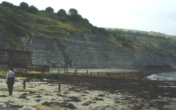
Lyme RegisWe arrived in Lyme Regis late in the morning - and so did most other people including the tour coaches and the regular buses. The centre of the town is a contortion of narrow winding streets that drop down off the plain behind into a small valley and then onto the beach. We were looking for a small street that ran to the right off the main road about half way down the hill as you come into the town centre. But there are no land marks to judge where you are so half way can only be deduced once you have reached the bottom (the road we wanted was of course too small to warrant a sign post and the locals conveniently all know where it is). So we reached the bottom of the hill and rightly concluded that we now needed to be half way up. Simple, turn around and look for the street on the left - but not in this traffic. The tour coaches had all stopped to disgorge tourists forcing the regular buses to stop in the middle of the road, forcing all other traffic to stop, and there we sat for some time contemplating the magnificent view of the back of a bus. However we did escape the traffic and we found the apartment where we had a pleasant lunch looking out over the English Channel. The sea looked remarkably calm but was mostly covered in fog. After lunch we took a pathway down to the boat harbour, walking out onto the famous breakwater (The Cob), then east along the beach past the town and towards the famous fossil cliffs. Being late in summer, the cliffs were showing the wear and tear of thousands of feet, driven by hopeful fossil hunters. Despite my years of successful fossil gathering, these cliffs had been picked clean. There were plenty of wonderful fossils to be had in the fossil and curio shops that line the main shopping street of Lyme, but to the expert eye 99% of the fossils were not from these parts, or even this country, and many of the so-called "crystals" were nothing more than cut glass. But it is the experience that counts, rather than the (empty) collection of fossils.
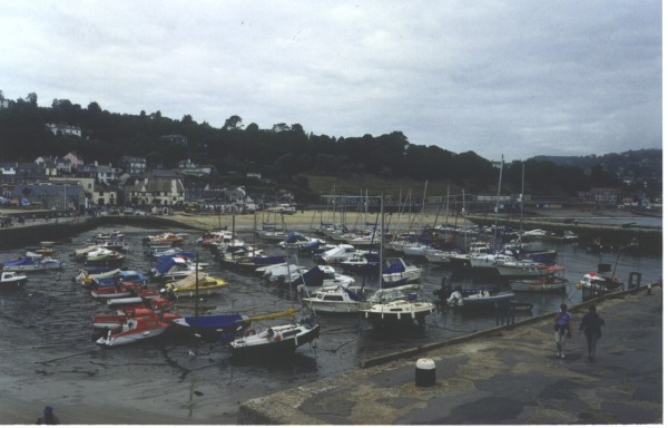
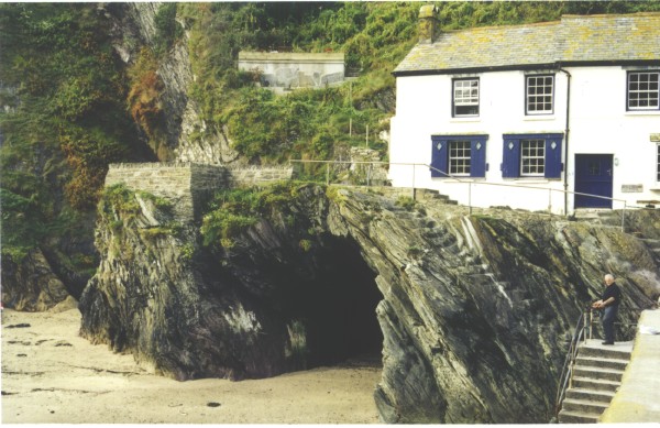
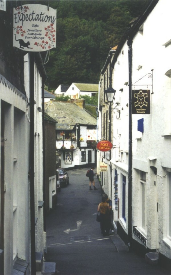
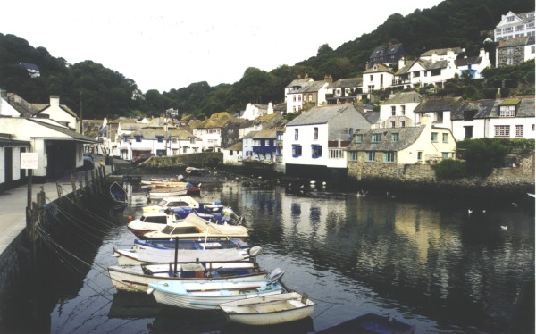
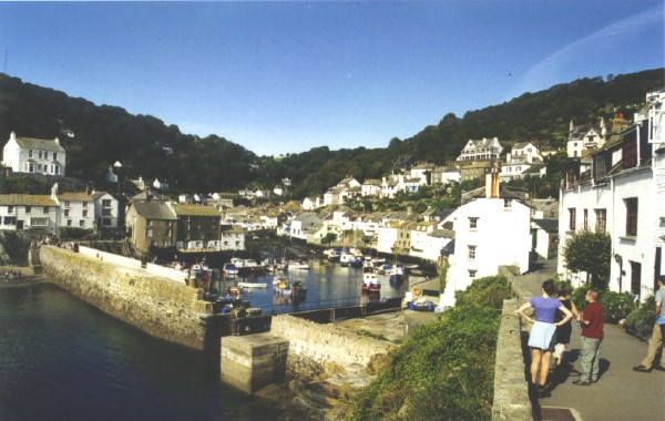
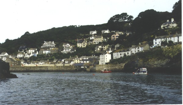
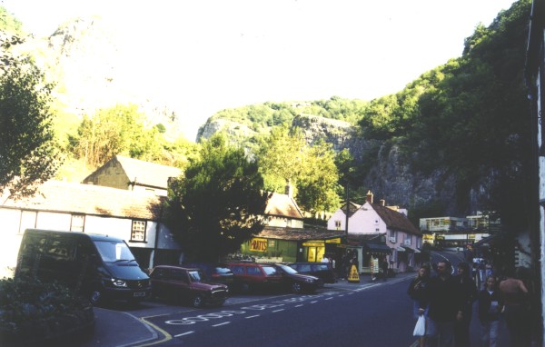
DAY 5Day 5 saw us heading southwest towards Lands End - or that was the plan, but again we had not come to terms with the quantity of travellers (high) and quality of roads (low) in this part of the country. So we headed SW on the A38, passing Plymouth before 9am, then dropping down onto the A387, arriving at Looe, (more info....) the charming river-mouth port, just as the coffee shop and tourist centre beside the bridge was opening its doors. No shortage of car parks at this time of day, so took an early morning photo then headed onwards on the narrow winding road as the traffic increased. We began to wonder where it was all going, thinking that it too might be headed for Polperro, but much to our surprise it wasn't and we had the pick of nearly 200 car parks at the entrance to Polperro. Once again our Antipodean propensity for early starts had some benefits. PolperroWe had heard a lot about the quaint charm of Polperro but did not know much in detail, so it was a pleasant time of discovery to walk the several hundred metres down the narrow valley into Polperro. Past stone houses that had probably been there hundreds of years, past shops, bakeries, tea rooms, pubs, restaurants (all still closed as this was only 10am) and on to the water's edge and the small sheltered port of Polperro. It was just past high tide and the boat harbour was full of calm reflective water, boats riding quietly at anchor. At the base of the breakwater that almost fully encloses the harbour was our first real sign of tourist entrapment - a woman selling tickets for a voyage along the coast on a local fishing boat. We were hooked on the idea and paid up. While we waited for the boat to fill (tourists were thin on the ground at this time of day) I had my first encounter with real Cornish slate - a wonderful black rock with such perfect slatey cleavage that it could and should have been in a text book. Then we found ourselves sailing out through the narrow gap in the breakwater and along the Cornish coast on a flat sea with gentle swell, past great headlands of slate and through thickets of kelp. We paused to catch a fleeting glance of a seal breakfasting near the shore then turned back. Now was the chance to see why this coast had such a reputation for shipwrecks and smuggling. Even from 500m offshore the harbour of Polperro was obscured by folds in the hills and coast. Only modern constructions (the storm water tunnel outfall, and large whitewashed houses) betrayed its existence. The boat headed for home against the out-rushing tide and dropped us off inside the harbour just in time to depart on the last of the water as the harbour emptied.
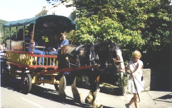
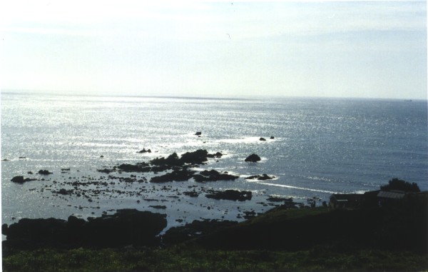
The boat trip had generated a thirst and a hunger, and by now the cafes had opened and visitors were pouring into the village, just as the water had poured out. We found a cafe wedged between buildings and overhanging a stream. It advertised tea, real coffee, cakes and clotted cream so in we went. I opted for the tea as experience had taught me that the English had mastered the brewing of this hot beverage, and we were informed that the scones with clotted cream were "Cornish teas" now that we had crossed the border from Devonshire. The barman, finding we were from New Zealand stretched his luck in trying to convince us that Cornish cream was better tasting than Devon but he would not be drawn on New Zealand cream. We then walked back up the valley, against the tide of visitors now surging down, past the cart loads of people, pulled by horses that were still munching grass when we arrived, and back to the car, now lost in a sea of vehicles in the very full car park. Lizard PointWe continued SW, past Truro then turned south on the A3083 towards Lizard Point. The traffic faded away and so did the houses as the land towards the coast became relatively desolate and bleak. At last we reached Lizard, and parked the car on the village green along with many others. It was then a comfortable walk downhill to the top of the cliffs at Lizard Point and the southern-most point of England.
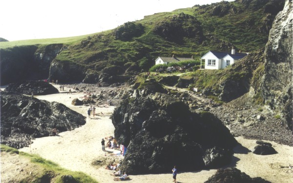
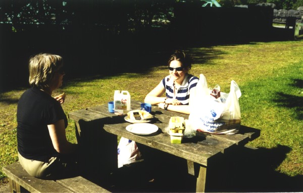
We strolled back up the path to the carpark, buying a small candleholder turned from local serpentine at one of the many souvenir shops that characterise the village of Lizard. Then a picnic lunch on the grass in the carpark, and for once we were not alone in dining from the boot of the car. A fellow picnicker was spotted brewing tea from an identical blue & green Thermos flask (but I doubt his had made the round trip to New Zealand)..... By now time was marching on and the remaining 33 miles to Lands End was looking impossible given the winding roads and amount of traffic, so we decided to visit the NT-managed beach of Kynance Cove, just west of Lizard. Kynance CoveKynance Cove is a small sheltered beach just west of Lizard. The coast and surrounding land is a wildlife reserve managed by the National Trust, who fleece you for using both their toll road and their beach. From an Antipodean perspective the beach was nothing special, but for England the mixture of white quartz sand, dark rocks and deep blue sea was quite spectacular. The sandy beach was crowded with people who had braved both the NT toll and the steep gravel path in order to lie imitating beached whales on the sand. RedruthFrom Lizard we abandoned all idea of reaching Lands End (heartened by the travel books that universally pan this place as an important stop on your travel route) and headed north instead to Redruth in the heart of Cornish mining country. Redruth has an extensive mining museum with displays and underground tours, but we arrived too late (~4pm) to visit these, so settled for the wonderful working display of a beam pumping engine. Then it was a slow trip north on the A30 and A38 to Plymouth where we decided to stop for dinner at a Brewer's Fayre establishment at Lockyers Quay. A nice location on the waterfront and a welcome drink and meai.
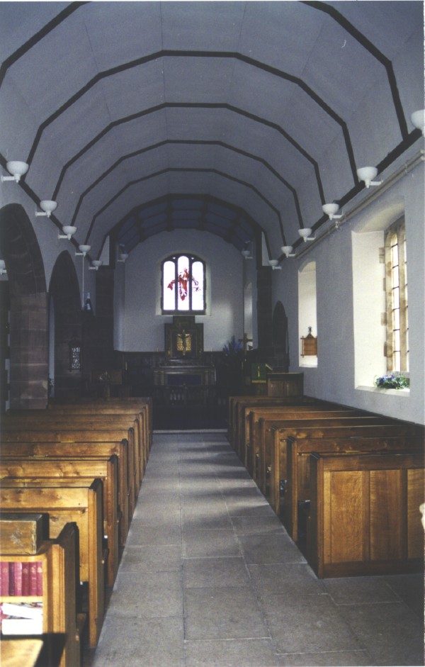
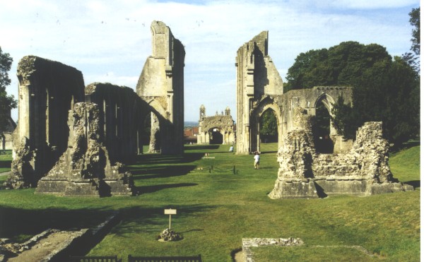
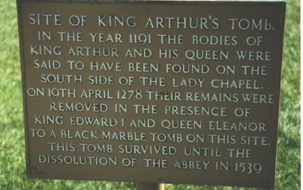
DAY 6Our stay at the Passage House, Kingsteignton had ended, so we departed and headed north towards Cheddar Gorge and Bath - or that was the plan, but we had not counted on this being Saturday and a wonderful fine sunny one at that. We travelled north on the A30 and A303 to Glastonbury and decided to stop and look at the ruined Abbey, not knowing much in advance about it. It was still early morning and we were among the first of today's visitors. The air was calm, had lost its early morning coolness but was still crisp and clear. The shadows were still long on the ground, emphasising the height and depth and the buildings. As the air warmed and the clouds gathered, the light became more muted and the ruins lost their sharpness and detail. On many occasions I noted that the British tourist has lost their connection with Nature, preferring to venture out in the late morning and return indoors by mid-afternoon and thereby failing to see the sights in optimal conditions. GlastonburyOn a whim we decided to stop and visit Glastonbury Abbey, having already seen Exeter Cathedral and numerous small village churches (there being a limit to the number of churches, cathedrals and castles one can appreciate). To our surprise Glastonbury filled in a large gap in our historical knowledge of England, covering the power and importance of the Abbot (the Abbot ay Glastonbury was landowner of all land in the SW of England and this is how he financed such a large Abbey) through the actions of Henry VIII in destroying both the power of the Church and the Abbey itself (many abbeys were spared as the Abbot rightly accepted "early retirement" from the position and both his life and his abbey were spared). At Glastonbury the Abbot refused to cede to Henry's men, so he was captured, hung for theft, and the Abbey destroyed. The Abbot's Kitchen remained intact as Henry's men lived there and dined on the food store. The Kitchen is now a remarkable example of architecture and kitchen design with its square base, octagonal roof and clever ventilation to extract the smoke and fumes of cooking. (More info....)
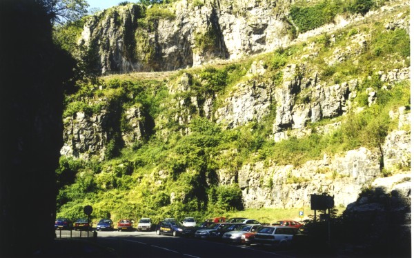
Cheddar GorgeOn northwards up the A371 to that most famous of English tourist traps - Cheddar Gorge. It was the geology, in particular the early geologists that attracted me to the gorge, and to the Mendip Hills that the gorge has been incised into. We arrived mid morning, ahead of the tour coaches and the hordes of tourists, but already the gorge was bustling with people. We found a car park just past the main caves/shops and walked back to the caves, paid our ransom for entrance tickets and entered Gough's Cave. (More info....) I have to admit that the cave was well laid out and designed for the typical tourist. To a New Zealander who has seen all of our major caves from Waitomo (More info....)to Takaka Hill, these caves at Cheddar were little more than cleverly lit tunnels, but to us it was the history and experience that was important.
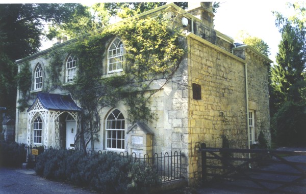
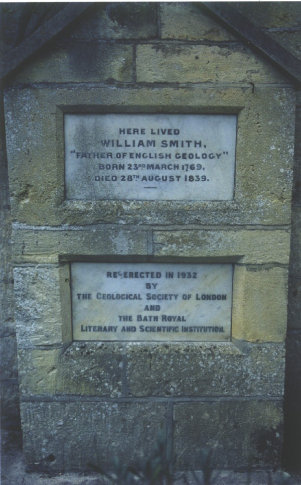
To provide further entertainment for the visitors, a set of 274 stairs has been built from the floor of the gorge to the top, where a lookout tower stands. Of all the attractions on the tourist ticket, this was the best, rewarding you with both some invigorating exercise and a magnificent view of the area. Then it was back to road level and a quick look in the shops. We decided to treat ourselves on a small block of REAL "cheddar". I also invested in a bottle of Somerset cider, having heard all about the cider apple trees, but this expenditure might be regarded as a mistake as the rest of the family were so taken by it, drinking large glasses of cider whilst sitting in the hot sun in the car park, that they insisted on drinking it in quantity throughout the rest of the tour. Tucking MillAfter a picnic lunch in the sun we continued on through the Gorge and out onto the Mendip Hills, turning west on the B3134 and descending past Aveline's Hole and the Rock of Ages (More info....) that inspired the hymn of that name. Then east on the A368 past Blagdon and Bishop Sutton towards Bath. We made a detour down a narrow lane to a location of 3 houses and small lake known as Tucking Mill. The house here is famous as the one-time home of William Smith, regarded as the Father of modern Geology, as it was Smith who drew the first geological map of England.
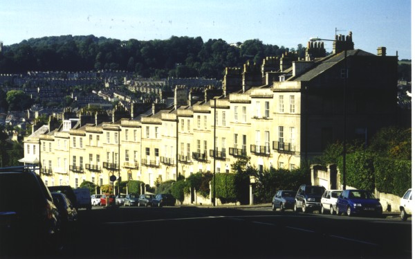
Bath!!!!!!!!%&*(^%$#@%********@#$%^&^*))))) !!!!!!!!!!!! We had some problems in Bath - navigation, one way roads, crowded streets on a fine Saturday afternoon, lack of car parks (and car park signs), so we have pencilled Bath in for our next visit....... [Postscript: I visited Bath again in 2008, outside of the tourist season and had no difficulty in finding my way around. We also visited in 2009, adn this time I knew where the car parks were. We drove straight to one close to the Roman baths and had an ecellent few hours walking around Bath.]
Hinton BlewettAccommodation was full in Bath and surroundings, so we headed back west towards Bishop Sutton where we had seen several B&B signs earlier in the day. These too proved full, but one owner kindly offered to ring a local farm stay, who had a vacancy. He then gave us complicated instructions "... turn left at the pub, head uphill for quite a while, past the village green, and turn right just past the pub, go to the end of the road, turn left and look for the sign of West End Farm on the gate." We followed these instructions and much to the owners surprise we found it, a lovely farm house on top of the Mendip hills with a view to the west in rural Somerset. The owner was a part-time game warden with broad Somerset accent and had lived locally all his life. He inquired if we had any plans for dinner, and offered to book us a table at the local pub. Given the rural nature of the village and the total absence of traffic as we approached, we decided to humour him and readily agreed to a booking. Well, that was our best decision of the day. Not only is the pub at Hinton Blewett a nice rural pub, it has an extensive menu and about 50 tables inside and out. Much to our surprise all tables were full by 8pm - we still don't know where all the people came from, but the pub appears to have a reputation in these parts...... The farm stay was a wonderful place and we fully recommend it. Not easy to find and not advertised.
DAY 7After a hearty farm breakfast we headed west then took the B3133 over the M5 and into Clevedon where we had arranged to meet a fellow genealogist. Found is house with ease and had a pleasant morning exchanging information, then we headed onto the M5 then across the Severn on the M4. We were now in Wales. Family locations in CardiffOur mission in Cardiff was to find the houses where Jane BEER had been brought up, and where she was working as a domestic nurse listed in the 1881 census. We felt there was a chance that the buildings still existed, so we followed the maps and found the streets. The Beer family had lived in a small apartment in a long row of houses - presuming the street had not been rebuilt. When it came to the house where she was a servant, there had been considerable rebuilding as one side of the street was modern buildings. Street numbers were absent from the other side, but after some counting we decided that an old, abandoned house was probably the one we wanted. Enquiries of an elderly neighbour confirmed this, and also told us that the house was due for demolition, delayed by neighbours' concerns over the size of the replacement. A few weeks later and the house would have gone. BreconWe then headed north on the A470 - a very pleasant drive - and stopped at the Garwant Forest for lunch, then on through the Brecon Beacons to Brecon and a B&B for the night.
End of Week 1 Last updated: 15/06/2017 |